On the morning of September 14th we left Grafton Marina for Alton, IL. While at Grafton we were able to repair our air conditioner with the pump that we had overnighted to us, and replace our bilge pump which decided to run continuously. The Mississippi between Grafton and Alton is really quite scenic with lots of rock cliffs along the shoreline. The picture below is the confluence of the Mississippi River and the Illinois. The Mississippi turns to the left and the Illinois is straight ahead on the Right.
 |
| Mississippi and Illinois River |
 |
| Mississippi River Shoreline |
Between Grafton and Alton, IL was the town of Portage des Sioux, Missouri. Located in this town is the Our Lady of the Rivers Shrine built in 1951 as gratitude of the river stopping just short of flooding the Village.
 |
| Our Lady of the Rivers Shrine |
Alton was not a stop that we had planned, but we were not able to get into Hoppies Marina down river until the night of the 17th so we added a stop in Alton. Alton turned out to be a very pleasant stop. We ate at a very interesting restaurant called Fast Eddies and we able to get some grocery shopping done in a local store that would picked us up at the marina. One night while there we attended a gathering of loopers. It was a barbecue where you bring your own meat and other dishes to share.
Early on the morning of the 17th of September we left Alton headed for Hoppies Marina only to wait 3 hours and 45 minutes at the Mel Price Lock only 2 1/2 miles down river. Luckily we had only a short wait at the Chain of Rocks Lock which came next.
While in the Mel Price Lock we came across these people in a canoe. Someone who talked to them said they were going to Texas.
 |
| Looking upstream as the Chain of Rocks Lock begins to empty |
Shortly after the Chain of Rocks Lock we came to the confluence of the Mississippi and the Missouri Rivers. This was the beginning of lots of commercial river traffic and lots of turbulence. It was very difficult to determine which tugs were moving and which were tied up to bollards in the middle of the river. We were able to successfully weave our way through the St. Louis Area and make our way south to Hoppies Marina.
 |
| Approaching the St. Louis Area |
 |
| St. Louis Arch and Downtown |
Hoppies Marina is a very interesting place. It consists of old barges connected in a line. Fern Hopkins the owner is a crusty old lady who probably knows more about the Mississippi and Ohio Rivers than anyone you will meet. She gives a class everyday at 4:30 PM and she puts out a wealth of information that made our next few days of travel much easier and safer. Before the class began Fern told us that we could just let the dogs run and Sadie had a great time running up and down those barges and playing with an English Spaniel named Monte.
 |
| Hoppies Marina |
 |
| Sadie Too at Hoppies Marina |
On September 18th we traveled from Hoppies to the Kaskaskia River where we spent the night tied up to the Kaskaskia Lock wall just up the Kaskaskia river a short ways from the Mississippi. We were not supposed to get out on the wall but there were three boats there and we walked between the boats as we pleased. There was a nice park that we were able to take the dingy to and let the dogs run and play.
 |
| On the wall at Kaskaskia Lock |
The morning of September the 19th we left shortly before daylight as we needed to go 110 miles to Boston Bar to Anchor. We would not normally be able to go that far but with about a 4 mph current on the Mississippi it was doable.
Our anchorage at Boston Bar was somewhat eventful. We anchored next to Rendezvous and first thing I took Sadie ashore to do her thing, I stopped and picked up her friend Monte but got called back to the boat just after the dogs got ashore. The wind had spun the Sadie Too and Rendezvous in a circle and our anchors were now crossed. It took some doing but we were able to get them straightened out. After that we spent the night with both boats on Rendezvous' anchor.
 |
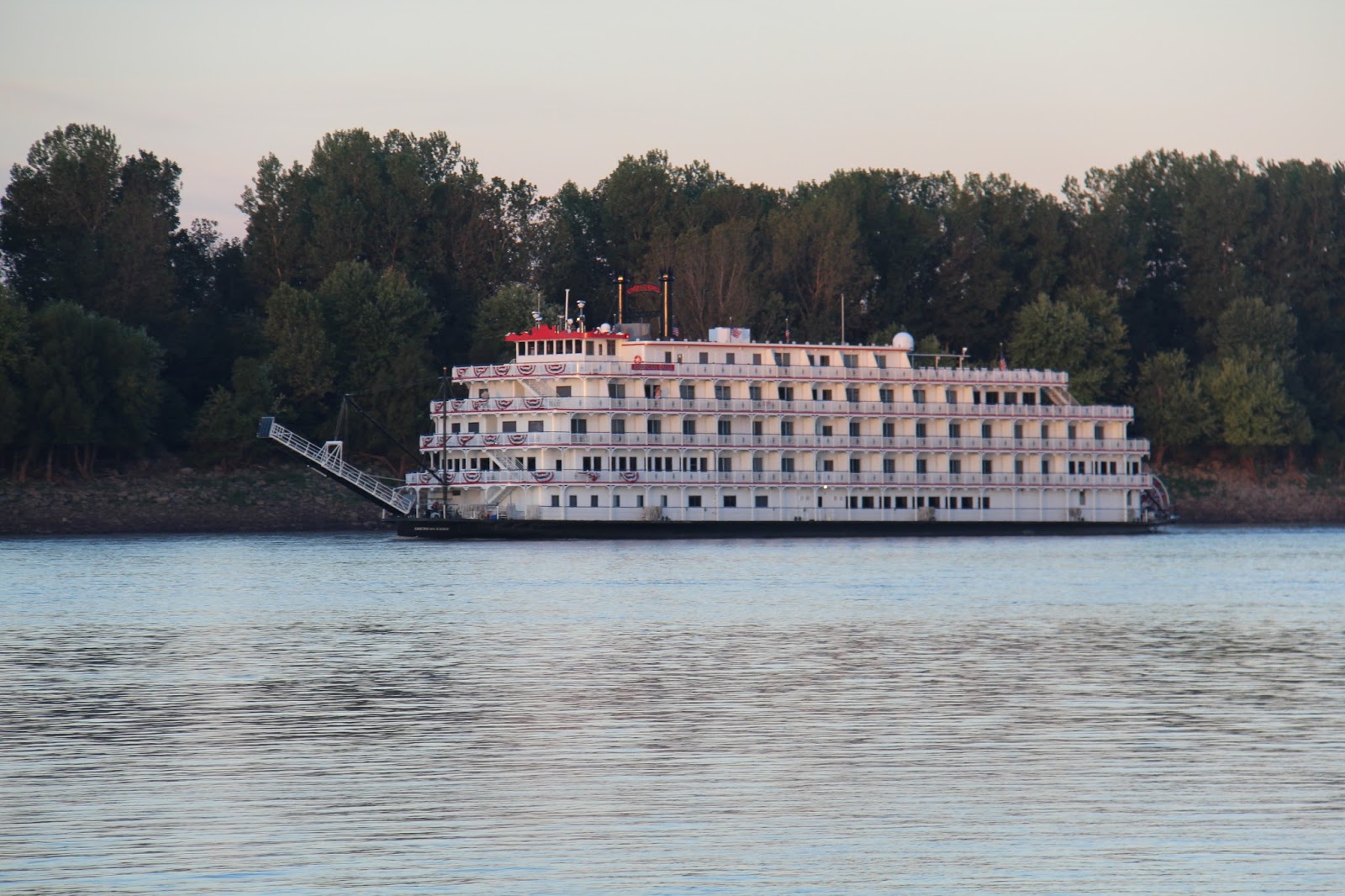
| Stern Wheeler seen from Boston Bar |
Above is a Mississippi Stern Wheeler which we saw pass while at Boston Bar. Not sure of which one it was as I could not read that name, even with the binoculars.
On the morning of the 20th of September we left Boston Bar for the remaining 7 miles to the confluence of the Mississippi and Ohio Rivers. One of the boats traveling with us said for us to go ahead and they would catch up. About 20 minutes down river they called and said they had run aground. Our cruising speed is 8 mph and with the 4mph current we were going 12 mph. We had gone 4 miles down river and going back up our speed was 4 mph. Luckily Rendezvous was faster than us and got back somewhat faster and was able, after may attempts, pull them off the rocks. They had a bent Prop and bottom damage but were able to continue.
After our second departure from Boston Bar we traveled down the Mississippi to the Ohio River and began traveling up river. We had heard horror stories about long waits at the locks on the Ohio River, due to construction on the new Olmstead lock and Dam, plus lock 52 has had their main lock chamber shut down for maintenance which left the smaller Aux. Chamber for all traffic. The Commercial traffic was waiting up to 36 hours.
We were lucky and we were able to pass thru the first lock on the Ohio, which is at Dam #53. This dam is a weir dam and during periods of high water the wickets are lowered and the water flows over the dam and the lock doors are opened and traffic passes thru the locks. We only had to wait less than an hour for a pilot boat to escort us through the construction area of the new Olmstead lock and dam which will eventually replace both lock and dam 53 and the next lock and dam upriver #52.
 |
| Pilot Safety Boat thru Lock 53 |
 |
| Our group thru Lock 53 (Sadie Too is 3rd boat) |
 |
Single file transit thru Olmstead Lock construction area
(Sadie Too is 3rd boat) |
Our wait at lock 53 was only about an hour but the lock was very slow and with the delays of this morning we did not get to our intended anchorage until after dark. We anchored at Cumberland Toe Head, where the Cumberland River runs into the Ohio. We got there after dark and Sadie had to go ashore. I took her ashore on Cumberland Toe Head Island. I stepped out of the dingy and sank to my knees in mud. I could not reach the radio in the dingy so I had to get out on my own but after a long struggle I got loose. Needless to say Sadie and I brought lots of mud back to the boat.
The next day September 21st we traveled up the Cumberland River to the Barkley Lock and Dam which forms Barkley Lake.
From the Dam we only had to go a couple of mile to Green Turtle Bay Marina for our next Stop.
 |
| Cumberland River |
 |
| Approaching Barkley Dam |
 |
| Entering Barkley Lock |


No comments:
Post a Comment